

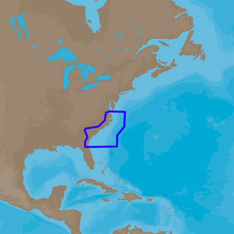
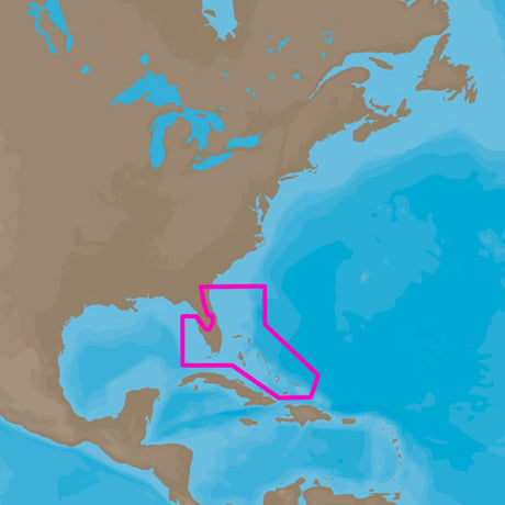
C-MAP 4D PC-D203 Carolinas, Kiribati, Marshall & Marianas - M-PC-D203-MS
C-MAP 4D PC-D203 Carolinas, Kiribati, Marshall & Marianas - M-PC-D203-MS is backordered and will ship as soon as it is back in stock.
Estimated Shipping Widget will be displayed here! (with custom color)
Authorized dealer
Authorized dealer
Your #1 trusted source for C-MAP products.
Shipping info
Shipping info
Most orders are processed and shipped from our USA warehouse within 1 to 3 business days of an order being placed (excluding weekends and holidays).
If, in the case, the item has a different handling and/or shipping estimate, it will be clearly displayed under the Add to cart button.
Returns info
Returns info
Eligible for returns: Yes
Time frame allotted: 30 days from the date of delivery
*Item(s) must be in new and unused condition to be eligible
To learn how to request a return please visit our return & refund policy:

Need assistance? We're happy to help!
 Call us
Description
Description
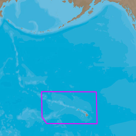
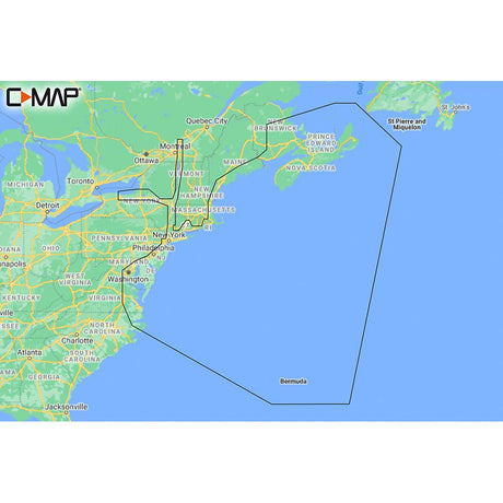
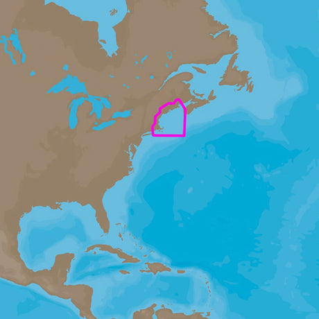
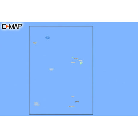
4D PC-D203 Carolinas, Kiribati, Marshall & Marianas
C-MAP 4D MAX+ is the latest evolution of electronic charting technology, combining award-winning vector chart data with exclusive Dynamic Raster Charts and the ability to view charts in 2D or amazing 3D presentation with high-resolution satellite imagery. Packed with innovative features designed to enhance every cruising, fishing, or sailing experience.
Features:
- Full-Featured Vector Charts - Provides a wealth of chart detail with the versatility to customize data layers and how they are viewed.
- Dynamic Raster - Traditional “paper chart” look with the unique ability to access information on buoys, lights, and other details. (Exclusive to 4D Max+)
- 3D View - Stunning three-dimensional views of land elevation and bottom contours bring the world around (and under) your boat to life. (Exclusive to 4D Max+)
- Satellite - High-resolution satellite imagery provides real-world reference and enhances situational awareness for coastal navigation. (Exclusive to 4D Max+)
- High-Resolution Bathy Data - The highest available detail of underwater pinnacles, ledges, and canyons that are magnets for offshore and coastal gamefish. Normally an additional purchase ($99 for Wide, $39 for Local), High-Resolution Bathy Data is now included in the price.
- Sport Fishing Data - Provides angling intelligence for wrecks and reefs, Fish ID photos, fishing tips, updated regulations, state records, and more. Normally an additional purchase ($49 for Wide, $19 for Local), Sport Fishing Data is now included in the price.
- Easy Routing - Automatically plots the shortest, safest route based on detailed chart data and user's vessel information. *Easy Routing is not available in the U.S. on the Humminbird product. (Exclusive to 4D Max+)
- Tides and Currents - interactive on-screen tide graphs and current arrow.
- Aerial Photos - Aerial pictures of harbor entrances, channels, and marinas.
- Guardian Alarms - Search and receive alerts for rocks, obstructions, shallows depths and other navigation hazards.
- Multi-Language Charts - More than 140 languages can be displayed using native character sets.
Manufacturer : C-MAP
Manufacturer Part No : M-PC-D203-MS
UPC : 9420024182185
Specifications
Specifications
| Specification | Unit |
|---|---|
| Card Format | MicroSD/SD |
Payment & Security
Payment methods
Your payment information is processed securely. We do not store credit card details nor have access to your credit card information.
More from C-MAP
View all-
 Free shippingUp to $29.99 off
C-MAP
C-MAP 4D NA-D942 Norfolk to Jacksonville
$199.00$228.99Unit price /UnavailableVery low stock (2 units) -
Free shippingUp to $29.99 off
C-MAP
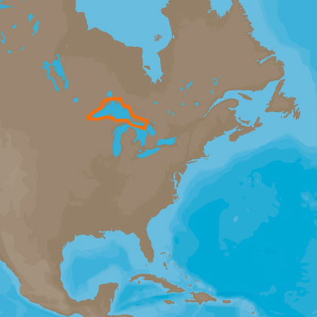
C-MAP 4D NA-D930 Lake Superior
$199.00$228.99Unit price /UnavailableVery low stock (2 units) -
Free shippingUp to $29.99 off
C-MAP
C-MAP 4D NA-D953 Point Sur to Cape Blanco
$199.00$228.99Unit price /UnavailableVery low stock (2 units) -
Free shippingUp to $38.09 off
C-MAP
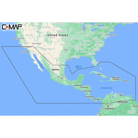
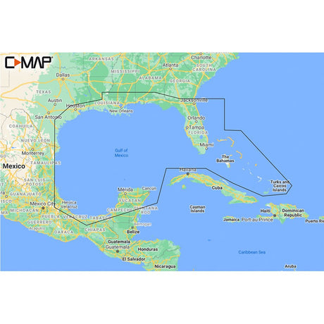
C-MAP M-NA-Y205-MS Central America & Caribbean REVEAL™ Coastal Chart
$249.90$287.99Unit price /UnavailableVery low stock (3 units) -
Free shippingUp to $29.99 off
C-MAP
C-MAP 4D NA-D932 Lake Huron and Georgian Bay
$199.00$228.99Unit price /UnavailableVery low stock (2 units) -
Free shippingUp to $29.99 off
C-MAP
C-MAP 4D NA-D946 Brownsville, TX to Coatzacoalcos, MX
$199.00$228.99Unit price /UnavailableVery low stock (2 units) -
Free shippingUp to $29.99 off
C-MAP
C-MAP 4D NA-D962 Unimak Pass to Attu Island
$199.00$228.99Unit price /UnavailableVery low stock (2 units) -
Free shippingUp to $29.99 off
C-MAP
C-MAP 4D NA-D963 Hawaiian Islands
$199.00$228.99Unit price /UnavailableVery low stock (2 units) -
Free shippingUp to $38.09 off
C-MAP
C-MAP M-NA-Y201-MS Great Lakes To Nova Scotia REVEAL™ Coastal Chart
$249.90$287.99Unit price /UnavailableVery low stock (3 units) -
Free shippingUp to $29.99 off
C-MAP
C-MAP 4D NA-D961 Bristol Bay to Amukta Pass
$199.00$228.99Unit price /UnavailableVery low stock (2 units) -
Free shippingUp to $29.99 off
C-MAP
C-MAP 4D NA-D955 Puget Sound, Juan De Fuca & San Juan Island
$199.00$228.99Unit price /UnavailableVery low stock (2 units) -
Free shippingUp to $29.99 off
C-MAP
C-MAP 4D NA-D952 San Diego to Santa Cruz
$199.00$228.99Unit price /UnavailableVery low stock (2 units) -
Free shippingUp to $38.09 off
C-MAP
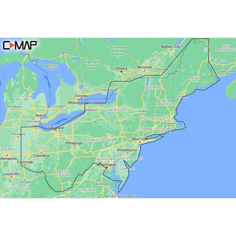
C-MAP M-NA-Y202-MS Nova Scotia to Chesapeake Bay REVEAL™ Coastal Chart
$249.90$287.99Unit price /UnavailableVery low stock (4 units) -
Free shippingUp to $29.99 off
C-MAP
C-MAP 4D NA-D939 Passamaquoddy Bay to Block Island
$199.00$228.99Unit price /UnavailableVery low stock (2 units) -
Free shippingUp to $38.09 off
C-MAP
C-MAP M-NA-Y210-MS Hawaii Marshall Islands French Polynesia REVEAL™ Coastal Chart
$249.90$287.99Unit price /UnavailableVery low stock (1 unit) -
Free shippingUp to $29.99 off
C-MAP
C-MAP 4D NA-D967 - Panama to Guatemala Local
$199.00$228.99Unit price /UnavailableVery low stock (2 units) -
Free shippingUp to $29.99 off
C-MAP
C-MAP 4D NA-D943 Florida & The Bahamas
$199.00$228.99Unit price /UnavailableVery low stock (2 units) -
Free shippingUp to $29.99 off
C-MAP
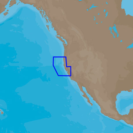
C-MAP 4D NA-D950 Gulf of Califonia , Mexico
$199.00$228.99Unit price /UnavailableVery low stock (2 units) -
Free shippingUp to $38.09 off
C-MAP
C-MAP M-NA-Y209-MS Canada North & East REVEAL™ Coastal Chart
$249.90$287.99Unit price /UnavailableVery low stock (1 unit) -
Free shippingUp to $29.99 off
C-MAP
C-MAP 4D NA-D938 Fundy, Nova Scotia Pei & Cape Breton
$199.00$228.99Unit price /UnavailableVery low stock (2 units) -
Free shippingUp to $26.09 off
C-MAP
C-MAP M-NA-Y213-MS US Lakes East REVEAL™ Inland Chart
$169.90$195.99Unit price /UnavailableVery low stock (1 unit) -
Free shippingUp to $38.09 off
C-MAP
C-MAP M-NA-Y204-MS Gulf of Mexico to Bahamas REVEAL™ Coastal Chart
$249.90$287.99Unit price /UnavailableVery low stock (3 units) -
Free shippingUp to $29.99 off
C-MAP
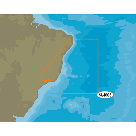
C-MAP 4D SA-D905 Recife to Rio De Janiero
$199.00$228.99Unit price /UnavailableVery low stock (2 units) -
Free shippingUp to $29.99 off
C-MAP
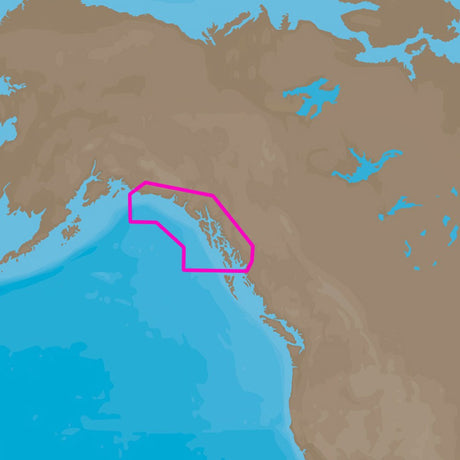
C-MAP 4D NA-D959 Dixon Entrance to Cape St. Elias
$199.00$228.99Unit price /UnavailableVery low stock (2 units)
More Marine - Cartography - C-Map 4D
View all-
Free shippingUp to $29.99 off
C-MAP
C-MAP 4D NA-D942 Norfolk to Jacksonville
$199.00$228.99Unit price /UnavailableVery low stock (2 units) -
Free shippingUp to $29.99 off
C-MAP
C-MAP 4D NA-D930 Lake Superior
$199.00$228.99Unit price /UnavailableVery low stock (2 units) -
Free shippingUp to $29.99 off
C-MAP
C-MAP 4D NA-D953 Point Sur to Cape Blanco
$199.00$228.99Unit price /UnavailableVery low stock (2 units) -
Free shippingUp to $29.99 off
C-MAP
C-MAP 4D NA-D932 Lake Huron and Georgian Bay
$199.00$228.99Unit price /UnavailableVery low stock (2 units) -
Free shippingUp to $29.99 off
C-MAP
C-MAP 4D NA-D946 Brownsville, TX to Coatzacoalcos, MX
$199.00$228.99Unit price /UnavailableVery low stock (2 units) -
Free shippingUp to $29.99 off
C-MAP
C-MAP 4D NA-D962 Unimak Pass to Attu Island
$199.00$228.99Unit price /UnavailableVery low stock (2 units) -
Free shippingUp to $29.99 off
C-MAP
C-MAP 4D NA-D963 Hawaiian Islands
$199.00$228.99Unit price /UnavailableVery low stock (2 units) -
Free shippingUp to $29.99 off
C-MAP
C-MAP 4D NA-D961 Bristol Bay to Amukta Pass
$199.00$228.99Unit price /UnavailableVery low stock (2 units) -
Free shippingUp to $29.99 off
C-MAP
C-MAP 4D NA-D955 Puget Sound, Juan De Fuca & San Juan Island
$199.00$228.99Unit price /UnavailableVery low stock (2 units) -
Free shippingUp to $29.99 off
C-MAP
C-MAP 4D NA-D952 San Diego to Santa Cruz
$199.00$228.99Unit price /UnavailableVery low stock (2 units) -
Free shippingUp to $29.99 off
C-MAP
C-MAP 4D NA-D939 Passamaquoddy Bay to Block Island
$199.00$228.99Unit price /UnavailableVery low stock (2 units) -
Free shippingUp to $29.99 off
C-MAP
C-MAP 4D NA-D967 - Panama to Guatemala Local
$199.00$228.99Unit price /UnavailableVery low stock (2 units) -
Free shippingUp to $29.99 off
C-MAP
C-MAP 4D NA-D943 Florida & The Bahamas
$199.00$228.99Unit price /UnavailableVery low stock (2 units) -
Free shippingUp to $29.99 off
C-MAP
C-MAP 4D NA-D950 Gulf of Califonia , Mexico
$199.00$228.99Unit price /UnavailableVery low stock (2 units) -
Free shippingUp to $29.99 off
C-MAP
C-MAP 4D NA-D938 Fundy, Nova Scotia Pei & Cape Breton
$199.00$228.99Unit price /UnavailableVery low stock (2 units) -
Free shippingUp to $29.99 off
C-MAP
C-MAP 4D SA-D905 Recife to Rio De Janiero
$199.00$228.99Unit price /UnavailableVery low stock (2 units) -
Free shippingUp to $29.99 off
C-MAP
C-MAP 4D NA-D959 Dixon Entrance to Cape St. Elias
$199.00$228.99Unit price /UnavailableVery low stock (2 units) -
Free shippingUp to $29.99 off
C-MAP
C-MAP 4D NA-D949 Acapulco, MX to Mazatlan, MX
$199.00$228.99Unit price /UnavailableVery low stock (2 units) -
Free shippingUp to $29.99 off
C-MAP
C-MAP 4D NA-D948 Champerico, GT to Acapulco, MX
$199.00$228.99Unit price /UnavailableVery low stock (2 units) -
Free shippingUp to $29.99 off
C-MAP
C-MAP 4D NA-D951 Cabo San Lucas, MX to San Diego, CA
$199.00$228.99Unit price /UnavailableVery low stock (2 units) -
Free shippingUp to $29.99 off
C-MAP
C-MAP 4D NA-D957 San Juan Islands to Nigei Island
$199.00$228.99Unit price /UnavailableVery low stock (2 units) -
Free shippingUp to $29.99 off
C-MAP
C-MAP 4D NA-D954 Cape Blanco to Cape Flattery
$199.00$228.99Unit price /UnavailableVery low stock (2 units) -
Free shippingUp to $29.99 off
C-MAP
C-MAP 4D NA-D933 Lake Erie and Lake St Clair
$199.00$228.99Unit price /UnavailableVery low stock (2 units) -
Free shippingUp to $29.99 off
C-MAP
C-MAP 4D NA-D958 Queen Charlotte, SD to Dixon Entrance
$199.00$228.99Unit price /UnavailableVery low stock (2 units)


Let customers speak for us

Quick response, will need more products in the near future

I like the simple design. Works well

does the job well

Extremely simple to install and assemble.

Works much better than expected. Bit tricky to maneuver, but does a great job overall.

This is definitely big and heavy but gets the job done. Finally got one, and it paid off after just a few stumps.

looks awesome with lifelike flames, runs all day, every day, and adds style without gobbling up electricity.

It's light, steady, and a blast to use.

Thinking about grabbing a couple more and maybe a solar charging setup.
Works better than expected, and assembly was simple.

Very satisfied with the boat 😊

chipper was easy to assemble and sturdy. exactly what i needed for clearing trees. just wish i had more time to use it!

Met expectations, very satisfied with performance.

Works as expected 🙂
Absolutely fantastic! Turned a mountain of branches into mulch in no time.
