

Garmin BlueChart® g3 Vision® VEI510S - Dnieper River & Azov Sea - microSD™/SD™ - 010-C1128-00
Garmin BlueChart® g3 Vision® VEI510S - Dnieper River & Azov Sea - microSD™/SD™ - 010-C1128-00 is backordered and will ship as soon as it is back in stock.
Estimated Shipping Widget will be displayed here! (with custom color)
Authorized dealer
Authorized dealer
Your #1 trusted source for Garmin products.
Shipping info
Shipping info
Most orders are processed and shipped from our USA warehouse within 1 to 3 business days of an order being placed (excluding weekends and holidays).
If, in the case, the item has a different handling and/or shipping estimate, it will be clearly displayed under the Add to cart button.
Returns info
Returns info
Eligible for returns: Yes
Time frame allotted: 30 days from the date of delivery
*Item(s) must be in new and unused condition to be eligible
To learn how to request a return please visit our return & refund policy:

Need assistance? We're happy to help!
 Call us
Description
Description
BlueChart® g3 Vision® VEI510S - Dnieper River & Azov Sea
Coverage: Detailed coverage of the Dnieper River from the Belarus-Ukrainian border to the Black Sea, the Sea of Azov and the Black Sea coast from the Danube Delta to Sochi, Russia, including the entire Crimean coast. Coverage includes the Kuban River to Krasnodar, the Kerch Strait, the Don River to Bagayevskiy and the Danube River to Braila, Romania.
See your vessel’s precise, on-chart position in relation to navaids, coastal features and restricted areas with premium features found in this detailed marine mapping data. Includes all of the features of our BlueChart® g2 HD product, plus 3-D perspective above and below the waterline, Auto Guidance, high-resolution imagery, and aerial photos of ports, harbors, marinas and landmarks.
Features:
- Shaded depth contours, coastlines, spot soundings, navaids, port plans, wrecks, obstructions, intertidal zones, restricted areas and IALA symbols
- Features up to 1-foot HD fishing contours which reveal detailed seafloor terrain
- Seamless transitions between zoom levels and more continuity across chart boundaries
- High resolution satellite imagery for a realistic view of the land and wate
- Aerial photos of ports, harbors, marinas, waterways, navigational landmarks and other POIs
- Garmin Auto Guidance technology is now capable of providing routing guidance¹ to virtually any accessible destination on the water
- Mariner’s Eye view 3-D perspective for a quick, easy position fix
- Fish Eye view 3-D perspective for an underwater view of the sea floor
- Safety Shading* enables contour shading for all depth contours shallower than your defined safe depths
- Fishing Charts* to scope out bottom contours and depth soundings with less visual clutter on the display
- Plan and organize routes from your computer with HomePort™
 WARNING: This product can expose you to chemicals which are known to the State of California to cause cancer, birth defects or other reproductive harm. For more information go to P65Warnings.ca.gov.
Manufacturer : Garmin
Manufacturer Part No : 010-C1128-00
UPC : 753759145651
Payment & Security
Payment methods
Your payment information is processed securely. We do not store credit card details nor have access to your credit card information.
More from Garmin
View all-
 Free shippingSold out
 -
 Free shippingUp to $210.00 off
Garmin
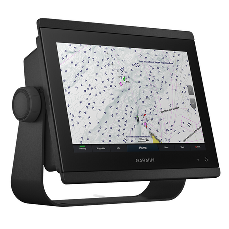
Garmin GPSMAP® 943 Chartplotter GN+ Non-Sonar With U.S. and Canada Mapping Navionics+ - 010-02366-60
$1,399.99$1,609.99Unit price /UnavailableVery low stock (2 units) -
Free shippingUp to $63.00 off
Garmin
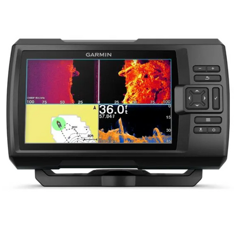
Garmin Striker Vivid 7cv 7" Fishfinder GPS Track Plotter With GT20 - 010-02552-00
$419.99$482.99Unit price /UnavailableIn stock -
Free shippingUp to $450.00 off
Garmin
Garmin GPSMAP® 1223xsv Combo GPS/Fishfinder - Worldwide - 010-02367-02
$2,999.99$3,449.99Unit price /UnavailableVery low stock (5 units) -
Free shippingSold out
Garmin
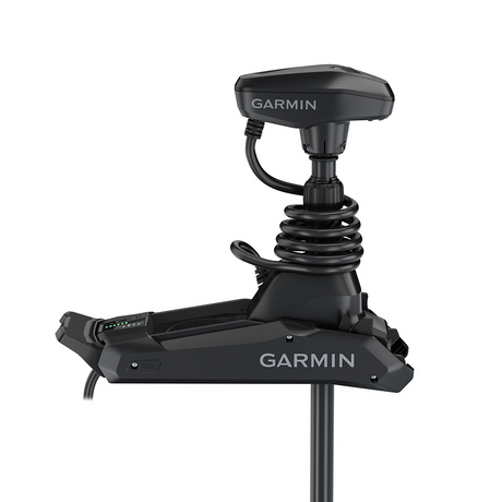
Garmin Force® Kraken Trolling Motor - 63" - Black with GT56UHD Transducer - 010-02573-00
$3,699.99$4,254.99Unit price /Unavailable -
Free shippingUp to $405.00 off
Garmin
Garmin GPSMAP® 8410xsv 10" Chartplotter/Sounder Combo with Worldwide Basemap - 010-02091-02
$2,699.99$3,104.99Unit price /UnavailableVery low stock (1 unit) -
Free shippingSold out
Garmin
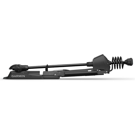
Garmin Force™ Freshwater Trolling Motor - 50" - 010-02024-00
$3,549.99$4,082.99Unit price /Unavailable -
Free shippingUp to $330.00 off
Garmin
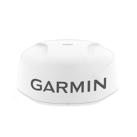
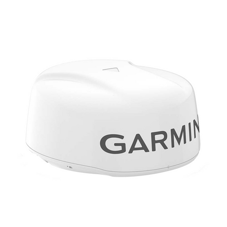
Garmin GMR Fantom™ 18x Dome Radar - White - 010-02584-00
$2,199.99$2,529.99Unit price /UnavailableLow stock (13 units) -
Free shippingUp to $78.00 off
Garmin
Garmin Striker Vivid 7sv 7"" Fishfinder Gps Track Plotter With Gt52 - 010-02553-00
$519.99$597.99Unit price /UnavailableLow stock (16 units) -
Free shippingUp to $450.00 off
Garmin
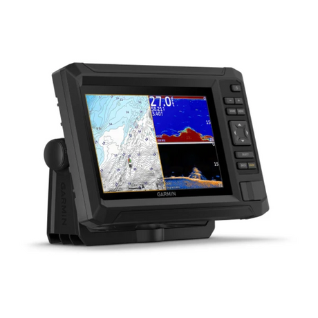
Garmin GPSMAP® 1243xsv Combo GPS/Fishfinder GN+ - 010-02367-61
$2,999.99$3,449.99Unit price /UnavailableIn stock -
Free shippingUp to $90.00 off
Garmin
$599.99$689.99Unit price /UnavailableLow stock (10 units) -
Free shippingUp to $540.00 off
Garmin
Garmin GPSMAP® 8612 Chartplotter GN+ - 010-02092-50
$3,599.99$4,139.99Unit price /UnavailableLow stock (14 units) -
 Free shippingUp to $600.01 off
Garmin
Garmin Echomap Ultra 2 106sv Livescope Plus Bundle With Gt56uhd-tm Transducer - 010-02880-01LSP
$3,999.98$4,599.99Unit price /UnavailableLow stock (10 units) -
Free shippingUp to $540.01 off
Garmin
Garmin Echomap Ultra 2 106sv Livescope Plus Bundle No Transducer - 010-02880-00LSP
$3,599.98$4,139.99Unit price /UnavailableLow stock (9 units) -
Free shippingUp to $660.01 off
Garmin
Garmin Echomap Ultra 2 126sv Livescope Plus Bundle No Transducer - 010-02882-00LSP
$4,399.98$5,059.99Unit price /UnavailableIn stock -
Free shippingUp to $720.01 off
Garmin
Garmin ECHOMAP Ultra 2 126sv LIVESCOPE Plus Bundle with GT56UHD-TM Transducer - 010-02882-01LSP
$4,799.98$5,519.99Unit price /UnavailableVery low stock (5 units) -
Free shippingUp to $720.01 off
Garmin
Garmin Echomap Ultra 2 122sv Livescope Plus Bundle With Gt56uhd-tm Transducer - 010-02881-01LSP
$4,799.98$5,519.99Unit price /UnavailableVery low stock (5 units) -
Free shippingUp to $600.01 off
Garmin
$3,999.98$4,599.99Unit price /UnavailableVery low stock (6 units) -
Free shippingUp to $19.00 off
Garmin
Garmin GPS 19x HVS NMEA 0183 - 010-01010-00
$180.99$199.99Unit price /UnavailableVery low stock (2 units) -
Free shippingUp to $158.00 off
Garmin
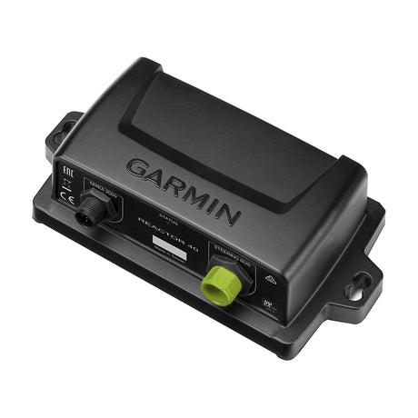
Garmin Course Computer Unit - Reactor™ 40 - 010-11052-67
$1,049.99$1,207.99Unit price /UnavailableVery low stock (3 units) -
Free shippingUp to $390.00 off
Garmin
Garmin Course Computer Unit - Reactor™ 40 Steer-by-wire - 010-11052-65
$2,599.99$2,989.99Unit price /UnavailableVery low stock (3 units) -
Free shippingSold out
Garmin
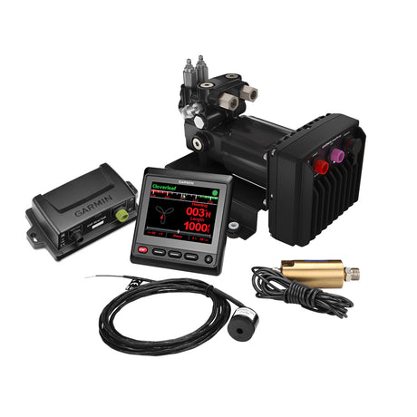
Garmin Reactor™ 40 Hydraulic Autopilot w/SmartPump v2 & GHC™ 20 Display - 010-00705-79
$4,099.99$4,199.99Unit price /Unavailable -
Free shippingSold out
Garmin
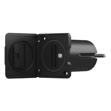
Garmin USB Card Reader w/USB-C Adapter Cable - 010-02251-10
$120.99$129.99Unit price /Unavailable -
 Free shippingUp to $750.00 off
Garmin
Garmin Panoptix™ PS70 Thru-Hull Transducer w/Fairing Block - 010-02768-00
$4,999.99$5,749.99Unit price /UnavailableVery low stock (2 units)


More Marine - Cartography - Garmin BlueChart Vision Foreign
View all-
Free shippingUp to $42.00 off
Garmin
Garmin BlueChart® g3 Vision® HD - VCA008R - Newfoundland West - microSD™/SD™ - 010-C0694-00
$307.99$349.99Unit price /UnavailableLow stock (17 units) -
Free shippingUp to $42.00 off
Garmin
Garmin BlueChart® g3 Vision® HD - VCA006R - P.E.I. to Chaleur Bay - SD Card - 010-C0692-00
$307.99$349.99Unit price /UnavailableLow stock (17 units) -
 Free shippingUp to $47.00 off
Garmin
Garmin BlueChart® g3 Vision® HD - VSA009R - Amazon River - microSD™/SD™ - 010-C1066-00
$302.99$349.99Unit price /UnavailableLow stock (17 units) -
Free shippingUp to $42.00 off
Garmin
Garmin BlueChart® g3 Vision® HD - VCA005R - Halifax - Cape Breton - microSD™/SD™ - 010-C0691-00
$307.99$349.99Unit price /UnavailableLow stock (17 units) -
Free shippingUp to $52.00 off
Garmin
Garmin BlueChart® g3 Vision® HD - VSA002R - South America West Coast - microSD™/SD™ - 010-C1063-00
$297.99$349.99Unit price /UnavailableLow stock (18 units) -
Free shippingUp to $63.00 off
Garmin
$386.99$449.99Unit price /UnavailableVery low stock (8 units) -
Free shippingUp to $42.00 off
Garmin
Garmin BlueChart® g3 Vision® HD - VCA004R - Bay of Fundy - microSD™/SD™ - 010-C0690-00
$307.99$349.99Unit price /UnavailableLow stock (17 units) -
Free shippingUp to $47.00 off
Garmin
Garmin BlueChart® g3 Vision® HD - VUS034R - Aleutian Islands - microSD™/SD™ - 010-C0735-00
$302.99$349.99Unit price /UnavailableLow stock (17 units) -
Free shippingUp to $47.00 off
Garmin
Garmin BlueChart® g3 Vision® HD - VCA018R - Inside - Outside Passage - microSD™/SD™ - 010-C1105-00
$302.99$349.99Unit price /UnavailableLow stock (17 units) -
Free shippingUp to $42.00 off
Garmin
$307.99$349.99Unit price /UnavailableLow stock (17 units) -
Free shippingUp to $42.00 off
Garmin
Garmin BlueChart® g3 Vision® HD - VCA013R - Labrador Coast - microSD™/SD™ - 010-C0698-00
$307.99$349.99Unit price /UnavailableLow stock (17 units) -
Free shippingUp to $47.00 off
Garmin
Garmin BlueChart® g3 Vision® HD - VCA019R - Hecate Strait - microSD™/SD™ - 010-C1106-00
$302.99$349.99Unit price /UnavailableLow stock (17 units) -
Free shippingUp to $47.00 off
Garmin
Garmin BlueChart® g3 Vision® HD - VSA001R - South America East Coast - microSD™/SD™ - 010-C1062-00
$302.99$349.99Unit price /UnavailableLow stock (17 units) -
Free shippingSold out
Garmin
Garmin BlueChart® g3 Vision® HD - VPC416S - New Zealand North - microSD™/SD™ - 010-C0874-00
$167.99$189.99Unit price /Unavailable -
Free shippingSold out
Garmin
Garmin BlueChart® g3 Vision® HD - VEU468S - Södertälje to Trelleborg - microSD™/SD™ - 010-C0812-00
$155.99$174.99Unit price /Unavailable -
Free shippingSold out
Garmin
Garmin BlueChart® g3 Vision® HD - VEU473S - Gulf of Bothnia, North - microSD™/SD™ - 010-C0817-00
$155.99$174.99Unit price /Unavailable -
Free shippingSold out
Garmin
Garmin BlueChart® g3 Vision® HD - VEU018R - The Netherlands - microSD™/SD™ - 010-C0775-00
$218.99$249.99Unit price /Unavailable -
Free shippingSold out
Garmin
Garmin BlueChart® g3 Vision® HD - VEU459S - Århs-Kiel-Koszalin - microSD™/SD™ - 010-C0803-00
$155.99$174.99Unit price /Unavailable -
Free shippingSold out
Garmin
Garmin BlueChart® g3 Vision® HD - VAE006R - Timor Leste/New Guinea - microSD™/SD™ - 010-C0881-00
$302.99$349.99Unit price /Unavailable -
Free shippingSold out
Garmin
Garmin BlueChart® g3 Vision® HD - VAE009R - Sin/Mal/Indonesia - microSD™/SD™ - 010-C0884-00
$302.99$349.99Unit price /Unavailable -
Free shippingSold out
Garmin
$155.99$174.99Unit price /Unavailable -
Free shippingSold out
Garmin
Garmin BlueChart® g3 Vision® HD - VEU502S - Azores Islands - microSD™/SD™ - 010-C0846-00
$155.99$174.99Unit price /Unavailable -
Free shippingSold out
Garmin
Garmin BlueChart® g3 Vision® HD - VEU054R - Vestfjd-Svalbard-Varanger - microSD™/SD™ - 010-C0790-00
$218.99$249.99Unit price /Unavailable -
Free shippingSold out
Garmin
Garmin BlueChart® g3 Vision® HD - VPC022R - East Coast Australia - microSD™/SD™ - 010-C0756-00
$218.99$249.99Unit price /Unavailable


Let customers speak for us

Quick response, will need more products in the near future

I like the simple design. Works well

does the job well

Extremely simple to install and assemble.

Works much better than expected. Bit tricky to maneuver, but does a great job overall.

This is definitely big and heavy but gets the job done. Finally got one, and it paid off after just a few stumps.

looks awesome with lifelike flames, runs all day, every day, and adds style without gobbling up electricity.

It's light, steady, and a blast to use.

Thinking about grabbing a couple more and maybe a solar charging setup.
Works better than expected, and assembly was simple.

Very satisfied with the boat 😊

chipper was easy to assemble and sturdy. exactly what i needed for clearing trees. just wish i had more time to use it!

Met expectations, very satisfied with performance.

Works as expected 🙂
Absolutely fantastic! Turned a mountain of branches into mulch in no time.
