

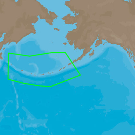
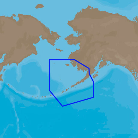
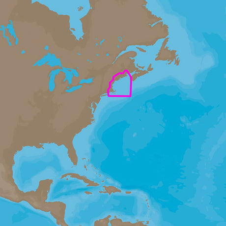
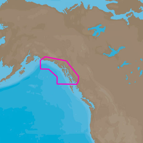
C-MAP M-NA-Y208-MS Alaska REVEAL™ Coastal Chart
C-MAP M-NA-Y208-MS Alaska REVEAL™ Coastal Chart is backordered and will ship as soon as it is back in stock.
Estimated Shipping Widget will be displayed here! (with custom color)
Authorized dealer
Authorized dealer
Your #1 trusted source for C-MAP products.
Shipping info
Shipping info
Most orders are processed and shipped from our USA warehouse within 1 to 3 business days of an order being placed (excluding weekends and holidays).
If, in the case, the item has a different handling and/or shipping estimate, it will be clearly displayed under the Add to cart button.
Returns info
Returns info
Eligible for returns: No
Purchases of this product are final and not eligible for return, refund, or exchange. Should you encounter any issues or concerns related to the product, we recommend reaching out to the manufacturer directly for assistance.

Need assistance? We're happy to help!
 Call us
C-MAP M-NA-Y208-MS Alaska REVEAL™ Coastal Chart
Description
Description
M-NA-Y208-MS Alaska REVEAL™ Coastal Chart
Whether cruising or fishing, C-MAP REVEAL™ Coastal charts offer the very best of C-MAP. With Shaded Relief, including Reveal Seafloor, Aerial Photography, Satellite Overlay and Dynamic Raster Chart presentation added to the core C-MAP features found in DISCOVER™ – full-featured Vector Charts, with Custom Depth Shading, Tides & Currents and Easy Routing. It also includes the very best of C-MAP High Resolution Bathymetry, including integrated Genesis® data. Purchase includes a full 12 months of online updates.
Vegetation
Vegetation layer comes from thousands of C-MAP Genesis & Biobase users personal sonar trips.
Bottom Composition
Bottom Composition layer comes from thousands of C-MAP Genesis and Biobase users personal sonartrips.
Raster Charts
Raster charts bring a traditional paper chart look and feel. *only available in C-MAP Reveal Coastal.
Shaded Relief
Shaded Relief will present the data with a 3D appearance, which is easier to interpret versus traditional contour lines.
Satellite Overlay
Satellite imagery provides real-world reference, enhances situational awareness for coastal navigation.
Features:
- Shaded Relief – bring the world around you to life, with 3D rendered land and underwater elevation – including areas of Ultra-High Resolution Bathymetric imagery previously only available in MAX-N+ Reveal – a game-changer for anglers.
- Aerial Photography – a collection of thousands of photos of marinas, harbors, inlets and other notable navigational features included to offer an additional level of detail.
- Satellite Overlay – satellite imagery gives information about the surroundings when you find yourself in an unfamiliar place.
- Dynamic Raster Charts – providing the traditional chart look and feel, coupled with easy access to all objects on the chart.
- Full Featured Vector Charts – making navigation easy by giving you accurate, up-to-date vector chart detail derive from official Hydrographic Office information.
- Custom Depth Shading – set a clear safety depth, maintain a paper-like view or create your own custom shading.
- High-Resolution Bathymetry – HRB layer helps you identify shallow areas, drop-offs, ledges, holes or humps. Now includes compiled and quality-controlled Genesis detail as part of singular HRB layer.
- Easy Routing – helps you automatically plot the shortest, safest route based on detailed chart data and your personalized vessel information.
- Tides & Currents – shows projections of water level and direction of tides to help plan your day out, cruising, angling or sailing.
- Detailed Marina Port Plans – docking in an unfamiliar port is no problem when you have precise layouts of thousands of marinas, including slip spaces, restricted areas and other valuable navigation information.
- Harbor & Approach Details – unprecedented level of detail. Approach any harbor and inlet with confidence. The perfect conclusion to a long voyage, sailing adventure or an exciting day of fishing.
- Online Updates – keep your chart up to date, with 12 months’ free online updates.
Product : C-MAP ALASKA REVEAL COASTAL CHART
Manufacturer : C-MAP
Manufacturer Part No : M-NA-Y208-MS
Product : C-MAP ALASKA REVEAL COASTAL CHART
Documentation

Payment & Security
Payment methods
Your payment information is processed securely. We do not store credit card details nor have access to your credit card information.
More from C-MAP
View all-
 Free shippingUp to $29.99 off
C-MAP
C-MAP 4D NA-D942 Norfolk to Jacksonville
$199.00$228.99Unit price /UnavailableVery low stock (1 unit) -
Free shippingUp to $29.99 off
C-MAP
C-MAP 4D NA-D930 Lake Superior
$199.00$228.99Unit price /UnavailableVery low stock (1 unit) -
Free shippingUp to $29.99 off
C-MAP
C-MAP 4D NA-D953 Point Sur to Cape Blanco
$199.00$228.99Unit price /UnavailableVery low stock (1 unit) -
Free shippingUp to $38.09 off
C-MAP
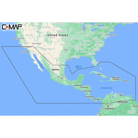
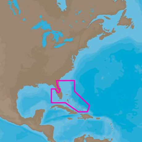
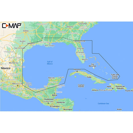
C-MAP M-NA-Y205-MS Central America & Caribbean REVEAL™ Coastal Chart
$249.90$287.99Unit price /UnavailableVery low stock (5 units) -
Free shippingUp to $29.99 off
C-MAP
C-MAP 4D NA-D932 Lake Huron and Georgian Bay
$199.00$228.99Unit price /UnavailableVery low stock (1 unit) -
Free shippingUp to $29.99 off
C-MAP
C-MAP 4D NA-D946 Brownsville, TX to Coatzacoalcos, MX
$199.00$228.99Unit price /UnavailableVery low stock (1 unit) -
Free shippingUp to $29.99 off
C-MAP
C-MAP 4D NA-D962 Unimak Pass to Attu Island
$199.00$228.99Unit price /UnavailableVery low stock (1 unit) -
Free shippingUp to $29.99 off
C-MAP
C-MAP 4D NA-D963 Hawaiian Islands
$199.00$228.99Unit price /UnavailableVery low stock (1 unit) -
Free shippingUp to $38.09 off
C-MAP
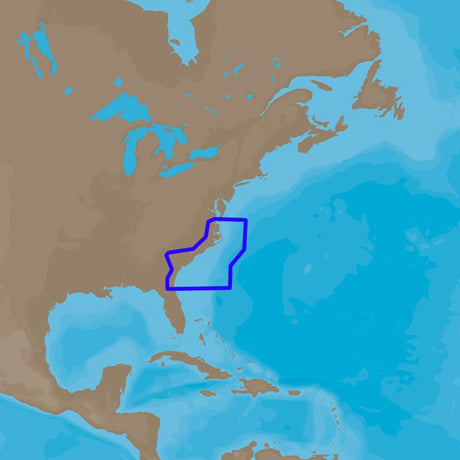
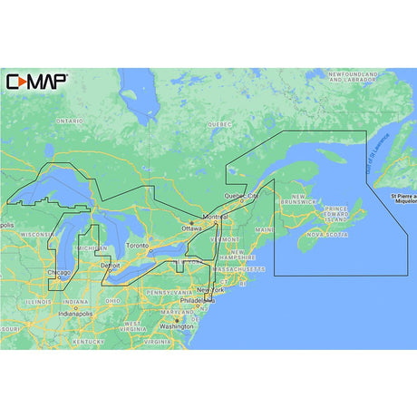
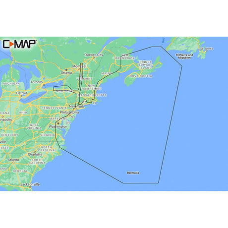
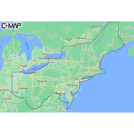
C-MAP M-NA-Y201-MS Great Lakes To Nova Scotia REVEAL™ Coastal Chart
$249.90$287.99Unit price /UnavailableVery low stock (5 units) -
Free shippingUp to $29.99 off
C-MAP
C-MAP 4D NA-D961 Bristol Bay to Amukta Pass
$199.00$228.99Unit price /UnavailableVery low stock (1 unit) -
Free shippingUp to $29.99 off
C-MAP
C-MAP 4D NA-D955 Puget Sound, Juan De Fuca & San Juan Island
$199.00$228.99Unit price /UnavailableVery low stock (1 unit) -
Free shippingUp to $29.99 off
C-MAP
C-MAP 4D NA-D952 San Diego to Santa Cruz
$199.00$228.99Unit price /UnavailableVery low stock (1 unit) -
Free shippingUp to $38.09 off
C-MAP
C-MAP M-NA-Y202-MS Nova Scotia to Chesapeake Bay REVEAL™ Coastal Chart
$249.90$287.99Unit price /UnavailableVery low stock (2 units) -
Free shippingUp to $29.99 off
C-MAP
C-MAP 4D NA-D939 Passamaquoddy Bay to Block Island
$199.00$228.99Unit price /UnavailableVery low stock (1 unit) -
Free shippingUp to $38.09 off
C-MAP
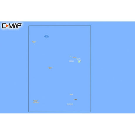
C-MAP M-NA-Y210-MS Hawaii Marshall Islands French Polynesia REVEAL™ Coastal Chart
$249.90$287.99Unit price /UnavailableVery low stock (3 units) -
Free shippingUp to $29.99 off
C-MAP
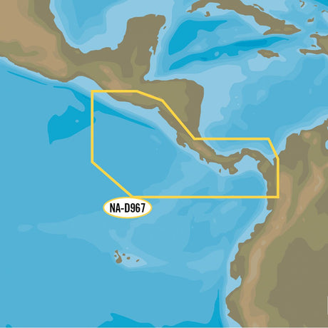
C-MAP 4D NA-D967 - Panama to Guatemala Local
$199.00$228.99Unit price /UnavailableVery low stock (1 unit) -
Free shippingUp to $29.99 off
C-MAP
C-MAP 4D NA-D943 Florida & The Bahamas
$199.00$228.99Unit price /UnavailableVery low stock (1 unit) -
Free shippingUp to $29.99 off
C-MAP
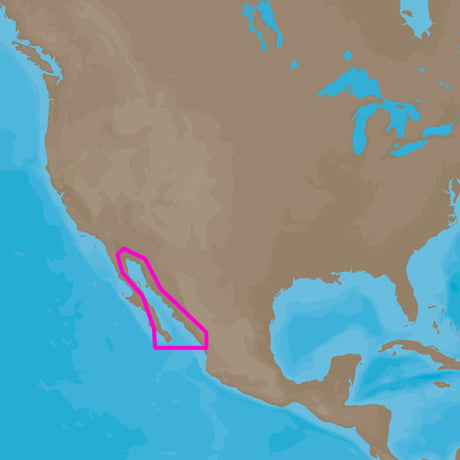
C-MAP 4D NA-D950 Gulf of Califonia , Mexico
$199.00$228.99Unit price /UnavailableVery low stock (1 unit) -
Free shippingUp to $38.09 off
C-MAP
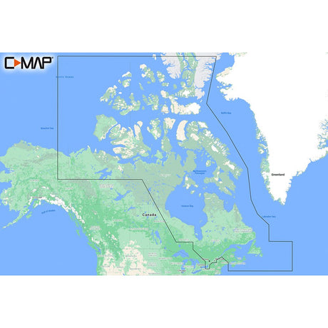
C-MAP M-NA-Y209-MS Canada North & East REVEAL™ Coastal Chart
$249.90$287.99Unit price /UnavailableVery low stock (3 units) -
Free shippingUp to $29.99 off
C-MAP
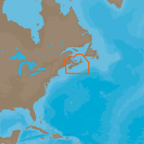
C-MAP 4D NA-D938 Fundy, Nova Scotia Pei & Cape Breton
$199.00$228.99Unit price /UnavailableVery low stock (1 unit) -
Free shippingUp to $26.09 off
C-MAP
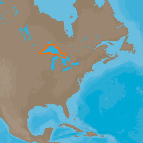
C-MAP M-NA-Y213-MS US Lakes East REVEAL™ Inland Chart
$169.90$195.99Unit price /UnavailableLow stock (11 units) -
Free shippingUp to $38.09 off
C-MAP
C-MAP M-NA-Y204-MS Gulf of Mexico to Bahamas REVEAL™ Coastal Chart
$249.90$287.99Unit price /UnavailableVery low stock (4 units) -
Free shippingUp to $29.99 off
C-MAP
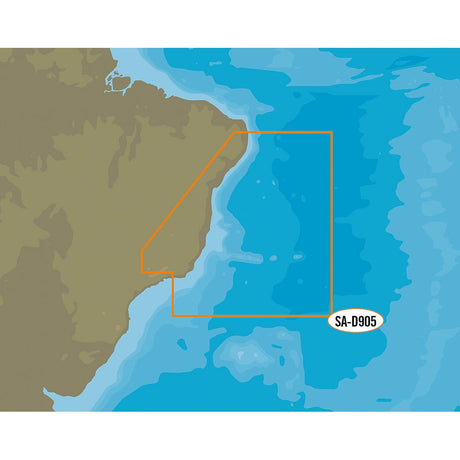
C-MAP 4D SA-D905 Recife to Rio De Janiero
$199.00$228.99Unit price /UnavailableVery low stock (1 unit) -
Free shippingUp to $29.99 off
C-MAP
C-MAP 4D NA-D959 Dixon Entrance to Cape St. Elias
$199.00$228.99Unit price /UnavailableVery low stock (1 unit)
More Marine - Cartography - C-Map Reveal
View all-
Free shippingUp to $38.09 off
C-MAP
C-MAP M-NA-Y205-MS Central America & Caribbean REVEAL™ Coastal Chart
$249.90$287.99Unit price /UnavailableVery low stock (5 units) -
Free shippingUp to $38.09 off
C-MAP
C-MAP M-NA-Y201-MS Great Lakes To Nova Scotia REVEAL™ Coastal Chart
$249.90$287.99Unit price /UnavailableVery low stock (5 units) -
Free shippingUp to $38.09 off
C-MAP
C-MAP M-NA-Y202-MS Nova Scotia to Chesapeake Bay REVEAL™ Coastal Chart
$249.90$287.99Unit price /UnavailableVery low stock (2 units) -
Free shippingUp to $38.09 off
C-MAP
C-MAP M-NA-Y210-MS Hawaii Marshall Islands French Polynesia REVEAL™ Coastal Chart
$249.90$287.99Unit price /UnavailableVery low stock (3 units) -
Free shippingUp to $38.09 off
C-MAP
C-MAP M-NA-Y209-MS Canada North & East REVEAL™ Coastal Chart
$249.90$287.99Unit price /UnavailableVery low stock (3 units) -
Free shippingUp to $26.09 off
C-MAP
C-MAP M-NA-Y213-MS US Lakes East REVEAL™ Inland Chart
$169.90$195.99Unit price /UnavailableLow stock (11 units) -
Free shippingUp to $38.09 off
C-MAP
C-MAP M-NA-Y204-MS Gulf of Mexico to Bahamas REVEAL™ Coastal Chart
$249.90$287.99Unit price /UnavailableVery low stock (4 units) -
Free shippingUp to $0.90 off
C-MAP
C-MAP M-NA-Y216-MS Canada Lakes REVEAL™ Inland Chart
$169.00$169.90Unit price /UnavailableLow stock (13 units) -
Free shippingUp to $38.09 off
C-MAP
C-MAP M-NA-Y208-MS Alaska REVEAL™ Coastal Chart
$249.90$287.99Unit price /UnavailableVery low stock (3 units) -
Free shippingUp to $38.09 off
C-MAP
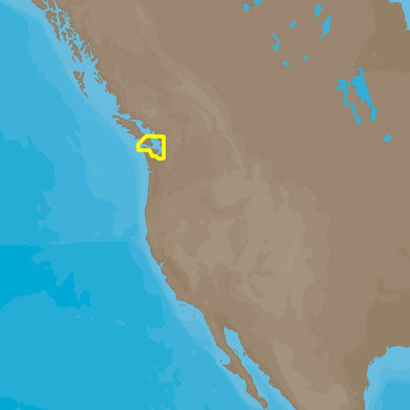
C-MAP M-NA-Y207-MS Columbia & Puget Sound REVEAL™ Coastal Chart
$249.90$287.99Unit price /UnavailableVery low stock (3 units) -
Free shippingUp to $26.09 off
C-MAP
C-MAP M-NA-Y212-MS US Lakes North Central REVEAL™ Inland Chart
$169.90$195.99Unit price /UnavailableLow stock (14 units) -
Free shippingUp to $38.09 off
C-MAP
C-MAP M-NA-Y203-MS Chesapeake Bay to Bahamas REVEAL™ Coastal Chart
$249.90$287.99Unit price /UnavailableLow stock (14 units) -
Free shippingUp to $38.09 off
C-MAP
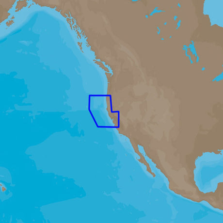
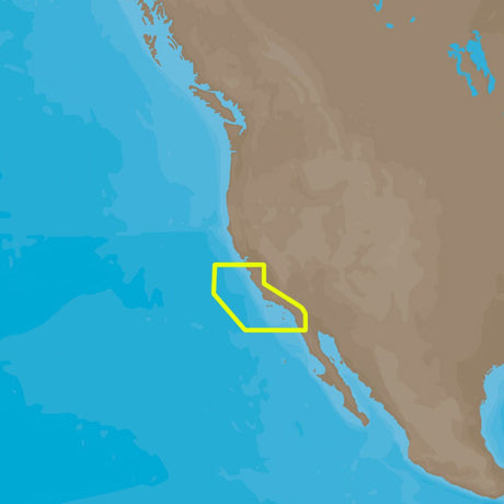
C-MAP M-NA-Y206-MS West Coast & Baja California REVEAL™ Coastal Chart - Does NOT contain Hawaii
$249.90$287.99Unit price /UnavailableVery low stock (3 units) -
Free shippingUp to $26.09 off
C-MAP
C-MAP M-NA-Y211-MS US Lakes West REVEAL™ Inland Chart
$169.90$195.99Unit price /UnavailableLow stock (16 units) -
Free shippingUp to $26.09 off
C-MAP
C-MAP M-NA-Y215-MS US Lakes South Central REVEAL™ Inland Chart
$169.90$195.99Unit price /UnavailableLow stock (17 units) -
Free shippingUp to $26.09 off
C-MAP
C-MAP M-NA-Y214-MS US Lakes South East REVEAL™ Inland Chart
$169.90$195.99Unit price /UnavailableIn stock -
Free shippingUp to $38.09 off
C-MAP
C-MAP REVEAL™ Chart - South America - East Coast - M-SA-Y501-MS
$249.90$287.99Unit price /UnavailableVery low stock (2 units)


Let customers speak for us

Quick response, will need more products in the near future

I like the simple design. Works well

does the job well

Extremely simple to install and assemble.

Works much better than expected. Bit tricky to maneuver, but does a great job overall.

This is definitely big and heavy but gets the job done. Finally got one, and it paid off after just a few stumps.

looks awesome with lifelike flames, runs all day, every day, and adds style without gobbling up electricity.

It's light, steady, and a blast to use.

Thinking about grabbing a couple more and maybe a solar charging setup.
Works better than expected, and assembly was simple.

Very satisfied with the boat 😊

chipper was easy to assemble and sturdy. exactly what i needed for clearing trees. just wish i had more time to use it!

Met expectations, very satisfied with performance.

Works as expected 🙂
Absolutely fantastic! Turned a mountain of branches into mulch in no time.
